Destination Details
| Destination: Cherrapunjee |
| Destination Type: Cities |
| City: Cherrapunji |
| Country: India |
- By Air : The Nearest Airport is Guwahati Airport 148 kms
- By Rail : The Nearest Railway Station is Guwahati 148 kms
- By Road : There are regular buses from other major cities of the country to Cherrapunji
Cherrapunjee, locally and officially known as Sohra, is 56 kms from Shillong, and a “must see” destination for all tourists. Apart from being the record holder for the heaviest rainfall, it was the headquarters of the Khasi/Jaintia province during British rule which was however shifted to Shillong in 1864, due to the inconvenience caused by excessive rain during the monsoon months.
The average rainfall is 12,000 mm a year and the record for a single day was 2455 mm recorded in 1974 confirming it as the “Wettest place on Earth”.
- Dain-Thlen Falls : Just before reaching Cherrapunjee a road to the right leads one to the falls which is 5 kms. away. Daiñ Thlen means cutting of the Thlen (a serpent monster).
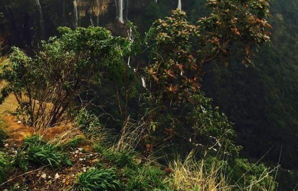
- Noh-Kalikai Falls : One of the most striking waterfalls and undoubtedly the highest in Meghalaya.
- Noh-Sngithiang Falls : Also known as Mawsmai Falls is actually a number of waterfalls cascading down to a conyon.
- Mawsmai Cave : The illuminated cave provide tourist an experience of caving.
- Thangkharang Park : It offers a panoramic view of the sleep cliffs and the Kynrem falls.
- Khoh Ramhah : The “Giants Basket” also known as “Motrop” is an imposing single formation in a shape of a giant cone.
- Living root Bridge : Located at the Laitkynsew and Nongriat villages.
- Visit Double Decker Living Root Bridge, Seven Sisters Falls , Eco Park & Mawkdok Dympep Valley